Maps

This gate on High Street is the entrance to the Coach Road that was used to reach Gorse Hall.
The red pin on the map below marks the gate's position.
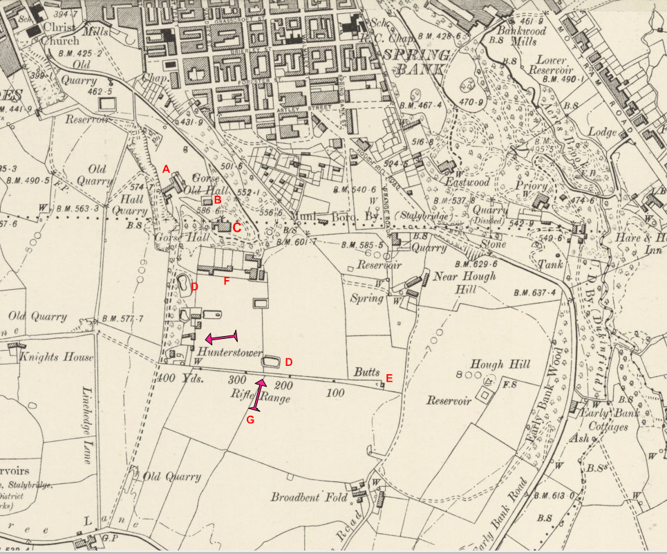
Map showing part of the estate - dated approximately 1900.
Key to Map:
A - The Stables B - Gorses (Old Gorse Hall) C - Gorse Hall D - Quarry Pits E - Rifle-Range Target
F - The kitchen garden. G - It is believed that the plane crashed near here
See images below the map
The ruins of the Stables – aerial view


Gorses before demolition
Gorse Hall
")

Gorse Hall being taken down. Only part of the building remains.
The quarry pit near Hunters Tower at the time of the murder.


Another quarry pit known locally as the “Blue Lagoon”. In the early 70s this was filled in after a young boy fell in and drowned.
Rifle range target wall
